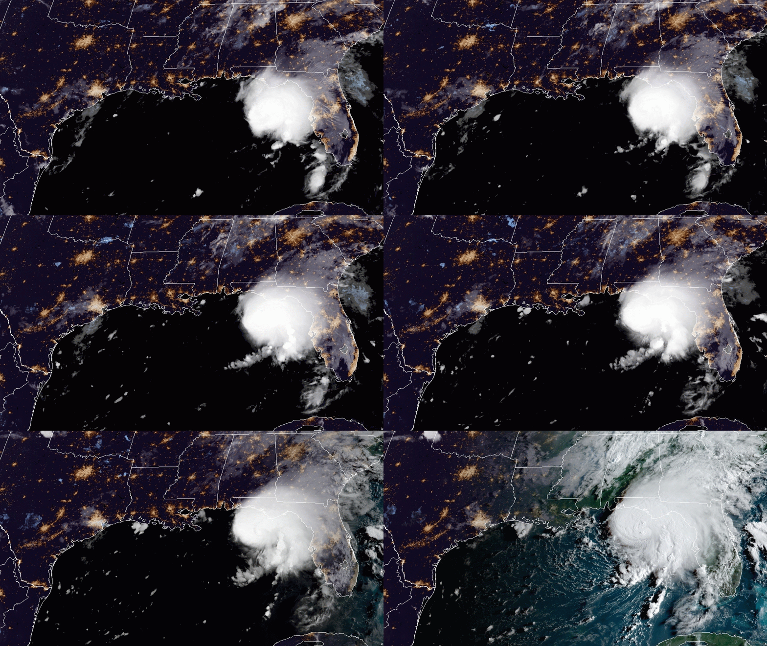
Fred has crossed the Florida Peninsula and has gained strength back to Tropical Storm status. Alabama Gov. Kay Ivey warned that the storm, on its current track, would impact southeast Alabama.
“Tropical Storm Fred’s current projected path includes Alabama,” Ivey said on social media. “We are keeping a close eye on this storm as the forecast develops and will be ready to act from the state level if needed. I encourage Alabamians and our visitors to stay weather aware.”
The storm is expected to continue to strengthen as it enters the northern Gulf of Mexico. At this point, the National Weather Service is predicting that the storm will make an impact on the Florida Panhandle coast and cross into southeast Alabama on Monday.
The Florida panhandle and Southeast Alabama, including Dothan, could experience flash, stream, and isolated river flooding on Monday and Tuesday. The storm is expected to turn and head through Georgia and the Carolinas on Tuesday.
Heavy storm surge is possible all along the Florida panhandle and the big bend area of Florida.
The city of Gulf Shores warns that there is a danger of high surf and/or rip currents Monday as the tropical storm enters the gulf.
If you insist on swimming and are caught in a rip current:
- Don’t fight the current.
- Swim out of the current and then to the shore.
- If you can’t escape, float or tread water.
- If you need help, call or wave for assistance.
Before entering the Gulf, please heed the advice of the beach safety patrol and the flag warning system.
Pay attention to the flag system. A red flag means high surf or dangerous currents, while a purple flag means dangerous marine life. Call 251-968-SURF for current surf conditions. On Sunday, Gulf Shores was flying both the red and purple flags.
According to the weather service, while Tropical Storm Fred shifted the east on Sunday afternoon, additional eastward shifts cannot be ruled out. Fred could make landfall as a tropical storm or strong tropical storm along the Florida panhandle sometime Monday afternoon into the evening. We still expect Fred to be lopsided with the majority of the impacts on the east side of the center.
The axis of heaviest rain shifted east somewhat and may continue to shift east with any further track adjustments today. Some 2-3 inches of rain is possible on Monday to the east of I-65 with isolated amounts of 4-6 inches possible across parts of Okaloosa County. Minor river flooding is also possible across the Florida panhandle if this much rain falls on Monday. A Flash Flood Watch remains in effect for these areas of Florida.
Inundation from coastal flooding of 1 to 3 feet is possible above normally dry ground is possible on Monday morning through the evening across northwest Florida, especially east of the Navarre, Florida, area.
High wave action could lead to wave run-up and minor beach erosion and flooding on all barrier islands.
Surf builds up to at least 5 to 8 ft and potentially 10+ ft near and east of the track on Monday. A high surf advisory and high surf warning are in effect through Tuesday morning. A high risk of rip currents is in effect Sunday night through Tuesday night.
The threat for sustained tropical storm-force winds will likely be confined close to the coast. Wind gusts to tropical storm force are possible further inland along and east of the track. The earliest time that tropical storm force winds would arrive is the pre-dawn hours on Monday at the coast and Monday afternoon inland. More than likely, we won’t see those winds until Monday afternoon along the coast and Monday evening further inland.
Tornadoes are possible on Monday across extreme south-central Alabama and northwest Florida.
Please note that Tropical Storm Grace is moving to the west on the heels of Fred. Please keep an eye on the forecast in the coming days as there will only be a few days in between the landfall of Fred and when Grace may potentially enter the Gulf on Thursday or Friday.


