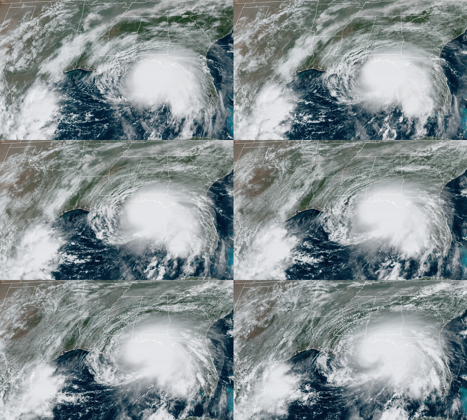
Tropical Storm Sally has intensified into a hurricane, according to the National Hurricane Center, prompting recommended evacuations along Alabama’s Gulf Coast as the storm approaches and continues an eastward drift that is bringing it closer to Alabama.
At 4 p.m. Monday, Hurricane Sally was upgraded to a Category 2 storm. Its more easterly track now includes coastal Alabama in its likely path.
“I would not want to ride this out on Dauphin Island due to storm surge and wind,” said ABC 33/40 meteorologist James Spann. “Emergency Management officials are now advising all visitors and residents in Zones 1 and 2 on either side of Mobile Bay (Mobile and Baldwin counties) evacuate before Hurricane Sally’s landfall.”
Here are the 4 PM CDT Key Messages for #Sally https://t.co/tW4KeFW0gB pic.twitter.com/5q9nyNWl8W
— National Hurricane Center (@NHC_Atlantic) September 14, 2020
Gov. Kay Ivey, the Alabama EMA and emergency management officials in Mobile and Baldwin counties are recommending evacuations for visitors and residents in some areas along the coast.
As #Sally moves closer to our Gulf Coast, I advise tourists & locals along AL’s coastline to evacuate. Folks, this storm is expected to cause wind damage, flooding, & storm surge. Be prepared. #alwx
Live traffic: https://t.co/8suxiPcCEF
Safety Tips: https://t.co/RlaggyVQnF
— Governor Kay Ivey (@GovernorKayIvey) September 14, 2020
Through a supplemental state of emergency declaration, Ivey closed all Alabama beaches effective at 3 p.m. and recommended the evacuation, especially of non-residents, and those living in flood-prone areas south of I-10.
“Alabamians are no stranger to tropical weather and the significant damage these storms can do, even though our state is not currently in the direct line of impact,” Ivey said. “Locals will need to prepare their homes, businesses and personal property for imminent storm surge, heavy rain and flash flooding. I urge everyone to tune in to their trusted weather source, and pay attention to your local officials for updates regarding your area as they make further recommendations based off the unique needs of your community. I am staying engaged with our emergency response team at the state level as well as our local officials in Mobile and Baldwin counties, and we will be providing assistance wherever needed. I ask everyone to use their best judgement and practice personal responsibility to ensure safety of themselves, their families and our first responders. Stay weather aware!”
Here are the latest coastal wind and storm surge warnings for Hurricane #Sally. More information is available at https://t.co/tW4KeFW0gB. Detailed local info is available at https://t.co/SiZo8ohZMN pic.twitter.com/VSCsJf30I5
— National Hurricane Center (@NHC_Atlantic) September 14, 2020
On Monday afternoon, the Baldwin County Emergency Management Agency asked people in low-lying areas of Zones 1 and 2 in Baldwin County to consider evacuating for their own safety.
{{CODE2}}
Mobile County made a similar recommendation.
{{CODE1}}
Hurricane Sally has strengthened rapidly. The National Hurricane Center says it is still too early to determine where Sally’s eye will move ashore given the uncertainty in the timing and location of Sally’s northward turn near the central Gulf Coast.
NHC’s average forecast error at 48 hours is around 80 miles, and dangerous storm surge, rainfall and wind hazards will extend well beyond the landfall of the storm eye.
Hurricane conditions are expected tonight on the coast from Southeastern Louisiana through the Alabama-Florida border. Tropical storm conditions could begin as soon as late this afternoon.
Hurricane preparations should be underway and rushed to a rapid completion Monday.
Life-threatening flash flooding is expected throughout the Alabama and Mississippi Gulf Coasts. Heavy rainfall is likely to also lead to widespread minor to isolated major flooding, on area rivers along and just inland of the Central Gulf Coast.
Significant flash and urban flooding are both expected to lead to minor to moderate river flooding across Mississippi and Alabama through the middle of the week.
This more easterly track has the storm going through Alabama south of Montgomery and Auburn while the track the NHC was forecasting earlier this morning had the remnants of Sally going through Tuscaloosa, Birmingham and Anniston.
There is still a strong possibility of heavy winds from the storm as well as the possibility of an isolated tornado.


